
#1096 – Dick Bernard: Thoughts About The Big Island of Hawaii
Today it is below zero here at home in Minnesota. One week ago today we left “on a jet plane” from Kailua-Kona airport on Hawaii, largest island of our nation’s 50th state. It had been in the 80s all day…. My first post about our trip is here.
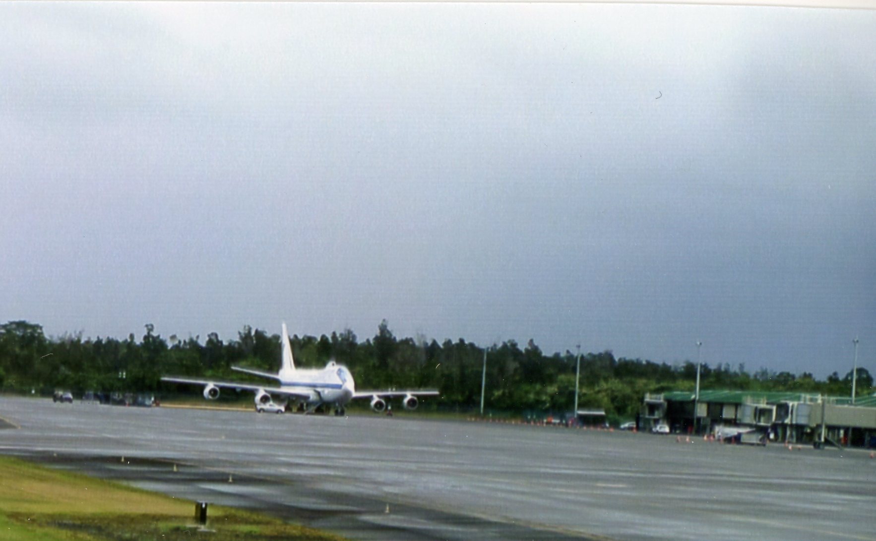
Presidents plane at Hilo Airport Dec. 22, 2015 (see note at end of post)
Dec 20 – Jan 4 2016 we were on the Big Island of Hawaii, our first such visit. My Dad, long before the word “blog” entered the vocabulary, used to say he traveled by looking at the pages of National Geographic.
Perhaps one or two or more readers will get some ideas about the wonderful Big Island from the following, and take it from there, through the Geographic or some other source.
(click to enlarge all photos)
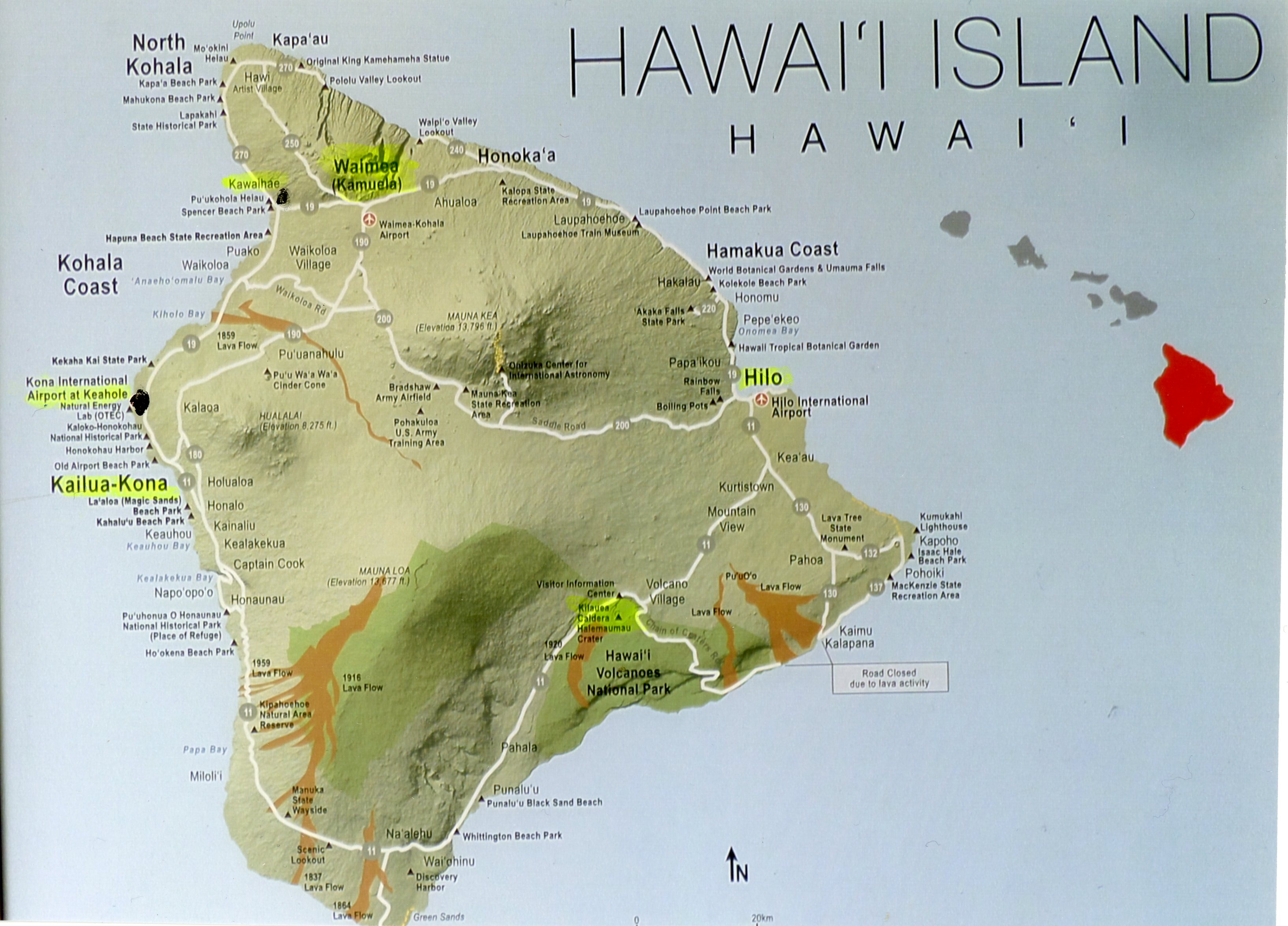
Big Island of Hawaii
The above map helps give context to the Big Island.
We stayed at my cousin Georgine’s rental property at Kawaihae Village, (the dot you see on the northwest (dry) side).
(If you’re planning a visit, consider staying at her place, link here.) Between us and the Kona airport (the other dot on the map) was 34 miles of excellent road. In between were several ‘gold coast’ resorts. Georgine’s home offers a great view of the west coast and the ocean, and all-around pleasant environment.
Hawaii owes its existence to volcanoes, past and present (see the brown areas on the map for more recent lava flows).
Mauna Kea and Mauna Loa dominate the island, with the “saddle road” in between. During our visit I circumnavigated the island, including saddle road, and travel by car was often relatively slow, but generally easy. (In Hawaii, unless you persist in staying on the coast, you’re either going up, or going down.)
I worried about the roads, with, it turned out, no basis at all.
A guide at Kilauea said the island, 4,000 or so square miles, is a bit smaller than Connecticut, and has only 190,000 population (Minnesota has about 87,000 square miles and 5.5 million population.) An islander we met said the island is more or less equally divided into five ethnic groups, one of which is Hawaiian; another, which one guide pronounced “howlers”, (not spelled that way) is more recent imports, non-Hawaii natives in any sense.
Hawaii hosts 11 of 13 climate types, I was told. Where we were was arid but pleasant grassland. Twenty miles away or less would be tropical vegetation groups. I think we experienced most of the climate types one time or another in our two weeks. Unless you elect to be chained to a resort, take warm clothes for excursions in higher country (Mauna Loa and Mauna Kea are Rocky Mountain elevations).
Walking distance from our house at Kwaihae was a very interesting ancient Hawaii historic site, Pu’ukohola Heiau. The text of the site brochure can be read here: Pu’ukohola Heiau001
There is a quiet, but not benign, tension remaining from the days of traditional Hawaii to the days of colonial empire (ca 1700s forward) to the present day.
An apparent standoff between protestors against the installation of a new observatory on the sacred mountain of Mauna Kea had closed the visitor center (which had the bathrooms).
There are lots of observatories and etc. already atop Mauna Kea. Enough was enough, apparently. As always, the issue depends on the perspective of the reporter….
Attempts at conversation to learn a true history of this paradise were unproductive. Whose version of “history” is true? This is always a legitimate question.
A tour guide in Honolulu suggested that a native collaborative culture had been replaced by a competitive one, without going into details….
Among other evidence of colonial actions (uncluding of course our own) the Hawaii flag features the English Union Jack instead of stars.
On arrival home, my cousin sent this link to a recent long article in a Business publication about current Native Hawaiian issues. It is worth a read, particularly for those with an interest in issues of native peoples, anywhere. Indigenous people may have been defeated in sundry ways, but they have not been beaten.
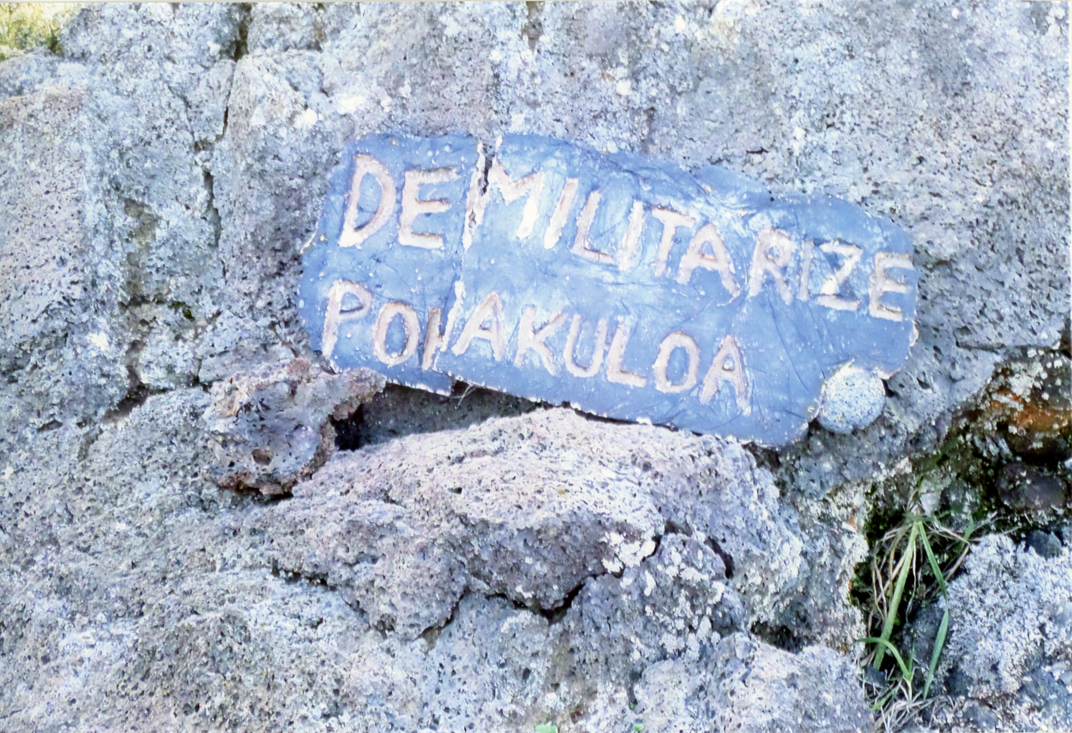
Much of the pristine appearing mountain area is not safe for people, in part because of unexploded old ammunition. The reason is that a significant section below Mauna Kea is a military reservation, Pohakuloa, and the empty areas of the island were long used for bombing and artillery training.
Waimea, a short drive from our vacation home, was used as a military training post following Tarawa beachhead in WWII.
We stopped at an information spot below Mauna Kea, and behind me was a carefully made protest sign made by someone about Pohakuloa. You can see it below.
My sister and her husband and myself took the drive to Kilauea Volcano on Jan. 3. The drive of about 90 miles was less than three easy hours from Kailua-Kona.
I had visions of an angry Kilauea before the trip. It is definitely active but was docile during our visit (the photo shows only part of the immense caldera, several miles across).
There is a brand new book about the scientist who made the volcano his life work, and for whom the visitor center at Kilauea is named. The book was reviewed in the Honololu Star Advertiser on Dec. 20. You can read the review here: Kilauea:Jaggar001
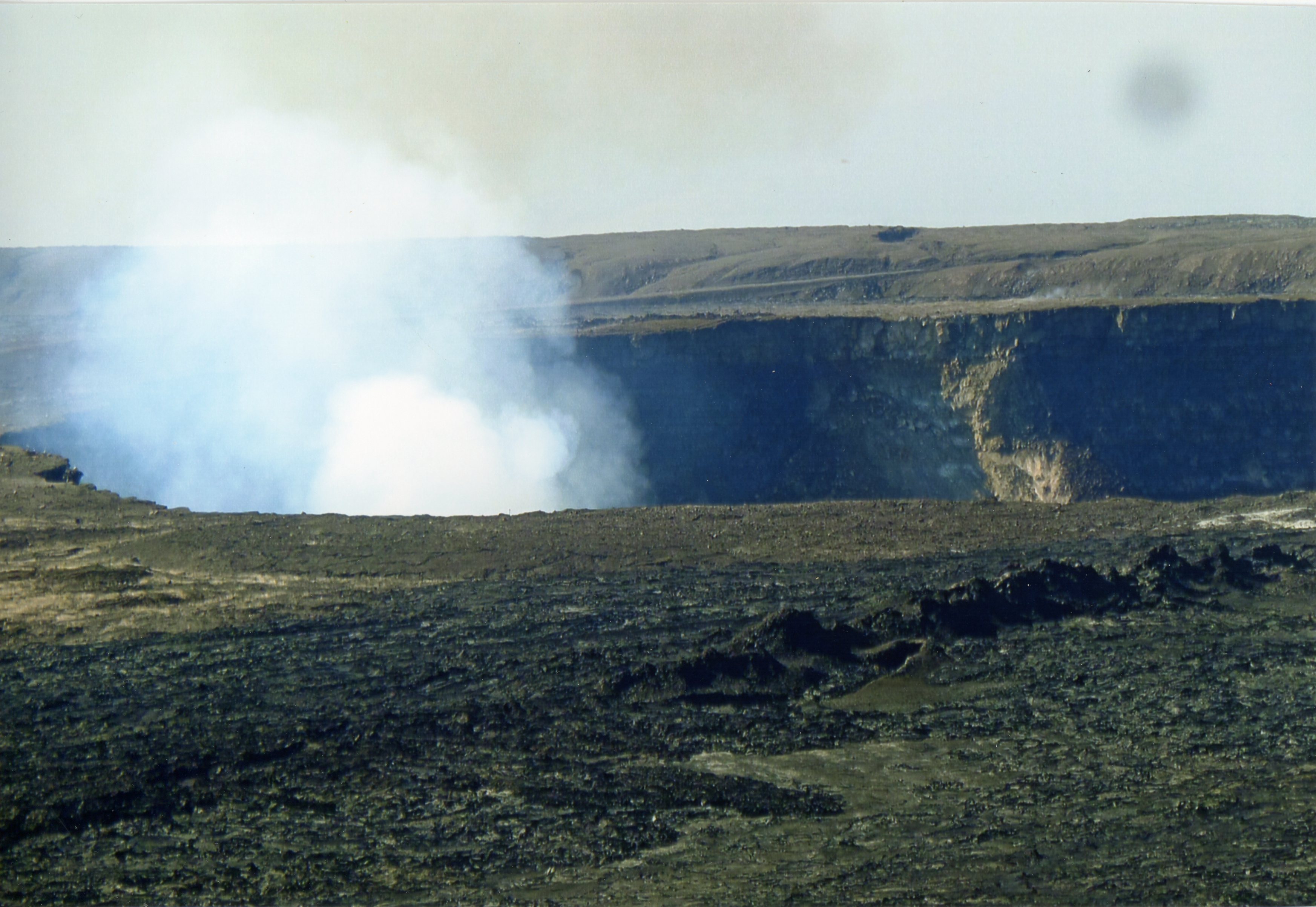
Kilauea Jan 3, 2016
Earlier in the week, grandson Ryan and I went on a doors-off helicopter ride over the Kilauea area. Georgine’s stepson Ryan Moeller was the excellent pilot (below)
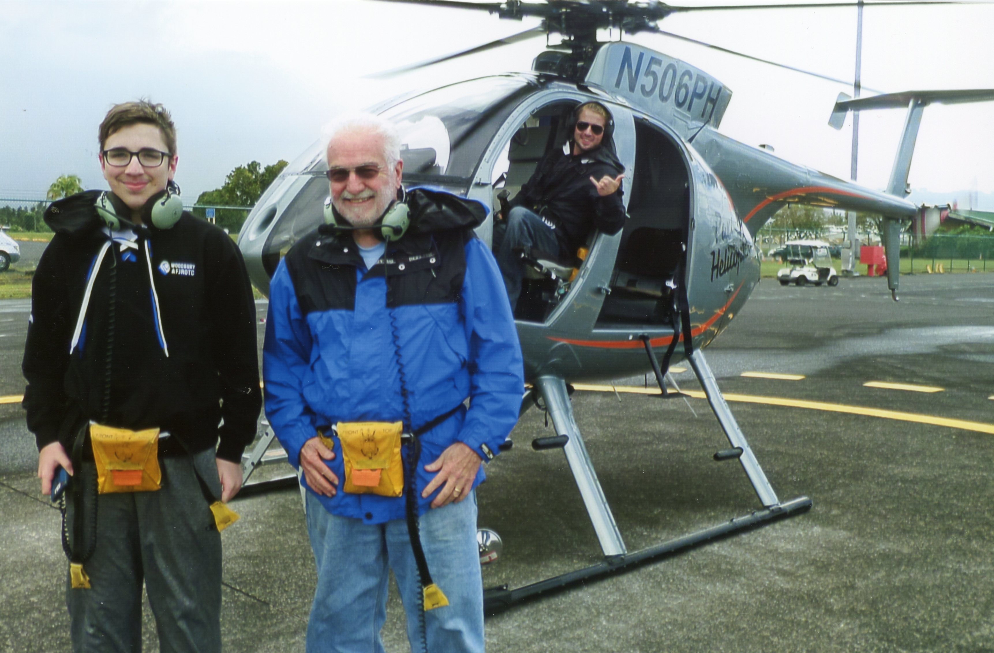
Ryan and Dick on return from Kilauea area, Dec. 22, 2015. Pilot Ryan Moeller expertly did the flying.
POSTNOTE: The photo that leads this post is the back up Air Force One, which we saw parked at Hilo airport on Dec. 22. President Obama and family were on vacation on Oahu, and it is apparently standard procedure to have an identical backup plane for the President when traveling. I took the photo from the helicopter as we were about to land.